Cadastral Mapping Services
Quality Services From Proffessionals
Our team is made of professionals with a combined experience of over twenty years. We deliver results

Cadastral
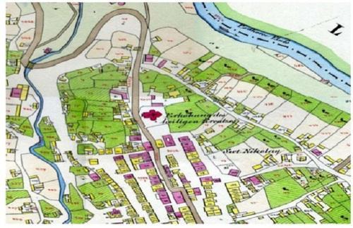
Cadastral mapping is a comprehensive register of the details related to the property of an area. These details include the precise location, dimensions, and other geographical classifications of the properties or individual parcels of land. The maps generated using cadastral mapping services help in effective management of public land records. National and local governmental bodies, architecture and engineering firms, real estate developers, industries can uses the cadastral mapping services for making well informed decisions. Cadastral mapping services also enable to user to study additional details, such as survey district names, unique identifying numbers for parcels, certificate of title numbers, positions of existing structures, section or lot numbers and their respective areas, adjoining street names, selected boundary dimensions and references to prior maps.
Landmetric provides cadastral mapping for creation of cadastral maps from hard copies of the administrative maps with specific details of each plot, roads, railway lines, water bodies, vegetation, etc. These cadastral mapping service provide all inclusive solutions to land information system problems by focusing on various forms of land records.